

E-Books → Anthropogeomorphology A Geospatial Technology Based Approach
Published by: voska89 on 9-03-2022, 00:20 |  0
0
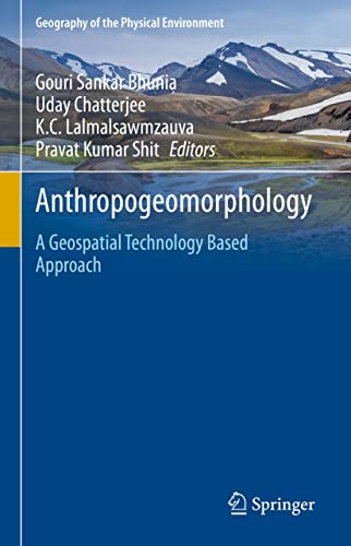
English | 2022 | ISBN: 3030775712 | 676 pages | True PDF EPUB | 268.06 MB
This book explores state-of-art techniques based on open-source software and statistical programming and modelling in modern geospatial applications, specifically focusing on recent trends in data mining techniques and robust modelling in Geomorphological, Hydrological, Bio-physical and Social activities. The book is organized into physical, mountainous, coastal, riverine, forest, urban and biological activities, with each chapter providing a review of the current knowledge in the focus area, and evaluating where future efforts should be directed. The text compiles a collection of recent developments and rigorous applications of Geospatial computational intelligence (e.g., artificial neural network, spatial interpolation, physical and environmental modelling and machine learning algorithms etc) in geomorphic processes from a team of expert contributors.The authors address the wide range of challenges and uncertainties in the study of earth system dynamics due to climate change, and complex anthropogenic interferences where spatial modelling may be applied in therisk assessment of vulnerable geomorphological landscapes.The book will act as a guide to find recent advancements in geospatial artificial intelligence techniques and its application to natural and social hazards. This information will be helpful for students, researchers, policy makers, environmentalists, planners involved in natural hazard and disaster management, NGOs, and government organizations.
E-Books → Geospatial Technology for Landscape and Environmental Management Sustainable Assessment and Planning
Published by: voska89 on 13-01-2022, 14:12 |  0
0
Geospatial Technology for Landscape and Environmental Management: Sustainable Assessment and Planning
English | 2022 | ISBN: 9811673721 | 436 Pages | PDF | 19 MB
Geospatial technology is a combination of state-of-the-art remote sensing and technology for geographic information systems (GIS) and global navigation satellite systems (GNSS) for the mapping and monitoring of landscapes and environment. The main thrust of using geospatial technology is to understand the causes, mechanisms, and consequences of spatial heterogeneity, while its ultimate objective is to provide a scientific basis for developing and maintaining ecologically, economically, and socially sustainable landscapes. This book presents new research on the interdisciplinary applications of geospatial technology for identification, assessment, monitoring, and modelling issues related to landscape, natural resources, and environmental management. The book specifically focuses on the creation, collection, storage, processing, modelling, interpretation, display, and dissemination of spatio-temporal data, which help to resolve environmental management issues including ecosystem change, resource utilization, land use management, and environmental pollution. The positive environmental impacts of information technology advancements with regard to global environmental and climate change are also discussed. The book addresses the interests of a wide spectrum of readers who have a common interest in geospatial science, geology, water resource management, database management, planning and policy making, and resource management.
E-Books → Geospatial Data Analytics and Urban Applications
Published by: voska89 on 13-01-2022, 12:19 |  0
0
Geospatial Data Analytics and Urban Applications
English | 2022 | ISBN: 9811676488 | 197 Pages | PDF | 8 MB
This book highlights advanced applications of geospatial data analytics to address real-world issues in urban society. With a connected world, we are generating spatial at unprecedented rates which can be harnessed for insightful analytics which define the way we analyze past events and define the future directions. This book is an anthology of applications of spatial data and analytics performed on them for gaining insights which can be used for problem solving in an urban setting. Each chapter is contributed by spatially aware data scientists in the making who present spatial perspectives drawn on spatial big data. The book shall benefit mature researchers and student alike to discourse a variety of urban applications which display the use of machine learning algorithms on spatial big data for real-world problem solving.
E-Books → COVID-19 Pandemic, Geospatial Information, and Community Resilience (True PDF)
Published by: voska89 on 13-12-2021, 10:29 |  0
0
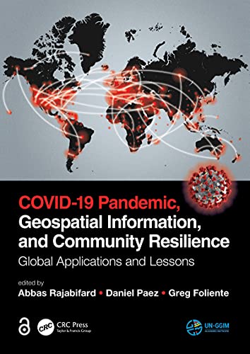
English | 2021 | ISBN: 9781003181590 | 559 pages | True PDF | 131.17 MB
Geospatial information plays an important role in managing location dependent pandemic situations across different communities and domains. Geospatial information and technologies are particularly critical to strengthening urban and rural resilience, where economic, agricultural, and various social sectors all intersect. Examining the United Nations' SDGs from a geospatial lens will ensure that the challenges are addressed for all populations in different locations. This book, with worldwide contributions focused on COVID-19 pandemic, provides interdisciplinary analysis and multi-sectoral expertise on the use of geospatial information and location intelligence to support community resilience and authorities to manage pandemics.
Video Training → Udemy - Geospatial APIs For Data Science Applications In Python
Published by: voska89 on 5-11-2021, 14:33 |  0
0

MP4 | Video: h264, 1280x720 | Audio: AAC, 44.1 KHz, 2 Ch
Genre: eLearning | Language: English | Duration: 71 lectures (5h 33m) | Size: 2.84 GB
Deploy Application Programming Interfaces (APIs) For Obtaining Geospatial Data and Carry Out Data Science Based Analysis
Video Training → Udemy - Introduction to Geospatial Technologies and Arcgis Interface
Published by: voska89 on 1-10-2021, 17:05 |  0
0

MP4 | Video: h264, 1280x720 | Audio: AAC, 44.1 KHz
Language: English | Size: 2.48 GB | Duration: 4h 33m
Geospatial Technologies & ArcGIS
Video Training → Udemy - Geospatial data analysis with python
Published by: voska89 on 30-08-2021, 18:22 |  0
0
MP4 | Video: h264, 1280x720 | Audio: AAC, 44.1 KHz, 2 Ch
Genre: eLearning | Language: English + srt | Duration: 30 lectures (2h 57m) | Size: 1 GB
Learn how to read, write and visualize the raster/vector dataset and perform spatial analysis using python
E-Books → Crime Modeling and Mapping Using Geospatial Technologies
Published by: voska89 on 29-08-2021, 15:54 |  0
0
Crime Modeling and Mapping Using Geospatial Technologies by Michael Leitner
English | PDF | 2013 | 445 Pages | ISBN : 9400749961 | 12.3 MB
Recent years in North America have seen a rapid development in the area of crime analysis and mapping using Geographic Information Systems (GIS) technology.
E-Books → Python Geospatial Development
Published by: ad-team on 12-08-2021, 23:48 |  0
0
Python Geospatial Development
pdf | 15.72 MB | English | Isbn: 978-1849511544 | Author: Erik Westra | Year: 2010
E-Books → Dorman Learning R For Geospatial Analysis 2014
Published by: ad-team on 4-07-2021, 04:46 |  0
0

Dorman Learning R For Geospatial Analysis 2014
pdf | 9.73 MB | English | Isbn: 1783984368 | Author: Michael Dorman | Year: 2014


