

E-Books → Green D GIS A Sourcebook for Schools 2000
Published by: Emperor2011 on 27-01-2023, 19:56 |  0
0

Green D GIS A Sourcebook for Schools 2000 | 3.69 MB
N/A | 251 Pages
Title: GIS: A Sourcebook for Schools
Author: David R.Green (edt)
Year: N/A
E-Books → Scale in Remote Sensing and GIS
Published by: voska89 on 7-01-2023, 13:40 |  0
0
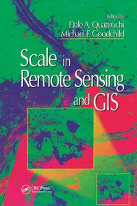
Scale in Remote Sensing and GIS
English | 1997 | ISBN: 9780203740170 | 447 pages | True PDF | 145.62 MB
The recent emergence and widespread use of remote sensing and geographic information systems (GIS) has prompted new interest in scale as a key component of these and other geographic information technologies. With a balanced mixture of concepts, practical examples, techniques, and theory, Scale in Remote Sensing and GIS is a guide for students and users of remote sensing and GIS who must deal with the issues raised by multiple temporal and spatial scales. Sixteen pages of full-color photographs help demonstrate key points made in the text.
Video Training → Mobile Gis And Mapping Applications With Leaflet
Published by: voska89 on 7-01-2023, 09:44 |  0
0

Last updated 11/2019
MP4 | Video: h264, 1280x720 | Audio: AAC, 44.1 KHz
Language: English | Size: 1.19 GB | Duration: 3h 59m
Take your applications outside, with or without connectivity
Video Training → Learning The Open Source Gis Stack Qgis 3X Desktop
Published by: voska89 on 7-01-2023, 09:37 |  0
0

Last updated 8/2019
MP4 | Video: h264, 1280x720 | Audio: AAC, 44.1 KHz
Language: English | Size: 4.16 GB | Duration: 7h 1m
become an expert in the open source GIS stack with QGIS 3.0 desktop.
E-Books → Application of Remote Sensing and GIS in Natural Resources and Built Infrastructure Management
Published by: voska89 on 5-01-2023, 08:30 |  0
0
Vijay P. Singh, "Application of Remote Sensing and GIS in Natural Resources and Built Infrastructure Management "
English | ISBN: 3031140958 | 2022 | 435 pages | PDF | 19 MB
This book discusses the problems in planning, building, and management strategies in the wake of application and expansion of remote sensing and GIS products in natural resources and infrastructure management. The book suggests proactive solutions to problems of natural resources and infrastructure management, providing alternatives for strategic planning, effective delivery, and growth perspectives. The uniqueness of the book is its broader spectrum of coverage with related interconnections and interdependences across science, engineering, and innovation. The book contains information that can be downscaled to the local level.
E-Books → Dealing with Disasters GIS for Emergency Management
Published by: voska89 on 31-12-2022, 15:37 |  0
0

Matt Artz, "Dealing with Disasters: GIS for Emergency Management "
English | ISBN: 1589486390 | 2021 | 150 pages | EPUB | 9 MB
Discover a modern approach to understanding threats and hazards that are more complex, costly, and devastating than ever before.
E-Books → Measuring Up The Business Case for GIS
Published by: voska89 on 25-12-2022, 09:11 |  0
0
Measuring Up: The Business Case for GIS by Cory Fleming, Christopher Thomas, Shannon Valdizon
English | May 31, 2022 | ISBN: 1589486242 | 200 pages | PDF | 31 Mb
How do leaders and innovators drive change and improvement?
E-Books → Learning from COVID-19 GIS for Pandemics
Published by: voska89 on 22-12-2022, 15:53 |  0
0
Learning From COVID-19
by Este Geraghty;Matt Artz;, Matt Artz
English | 2022 | ISBN: 1589487117 | 250 pages | True EPUB | 9.38 MB
E-Books → GIS and Public Health, 2nd Edition
Published by: voska89 on 22-12-2022, 15:10 |  0
0
Ellen K. Cromley, Sara L. McLafferty, "GIS and Public Health, 2nd Edition"
English | 2011 | pages: 530 | ISBN: 1609187504 | PDF | 12,8 mb
Authoritative and comprehensive, this is the leading text and professional resource on using geographic information systems (GIS) to analyze and address public health problems. Basic GIS concepts and tools are explained, including ways to access and manage spatial databases. The book presents state-of-the-art methods for mapping and analyzing data on population, health events, risk factors, and health services, and for incorporating geographical knowledge into planning and policy. Numerous maps, diagrams, and real-world applications are featured. The companion Web page provides lab exercises with data that can be downloaded for individual or course use.
Graphics & Design → Netcad GIS 2023 v8.5.3.1063
Published by: voska89 on 30-11-2022, 14:23 |  0
0

Netcad GIS 2023 v8.5.3.1063 | 1.3 GB
We integrate the convenience of CAD-based data production with the comprehensive rules of the GIS environment.


